Category Archives: Co. Mayo

Glensaul National School, Greenaun Townland, Co. Mayo

Glensaul National School, Greenaun townland, Co. Mayo
(Dated mid-20th Century)
NGR: 105539, 265891

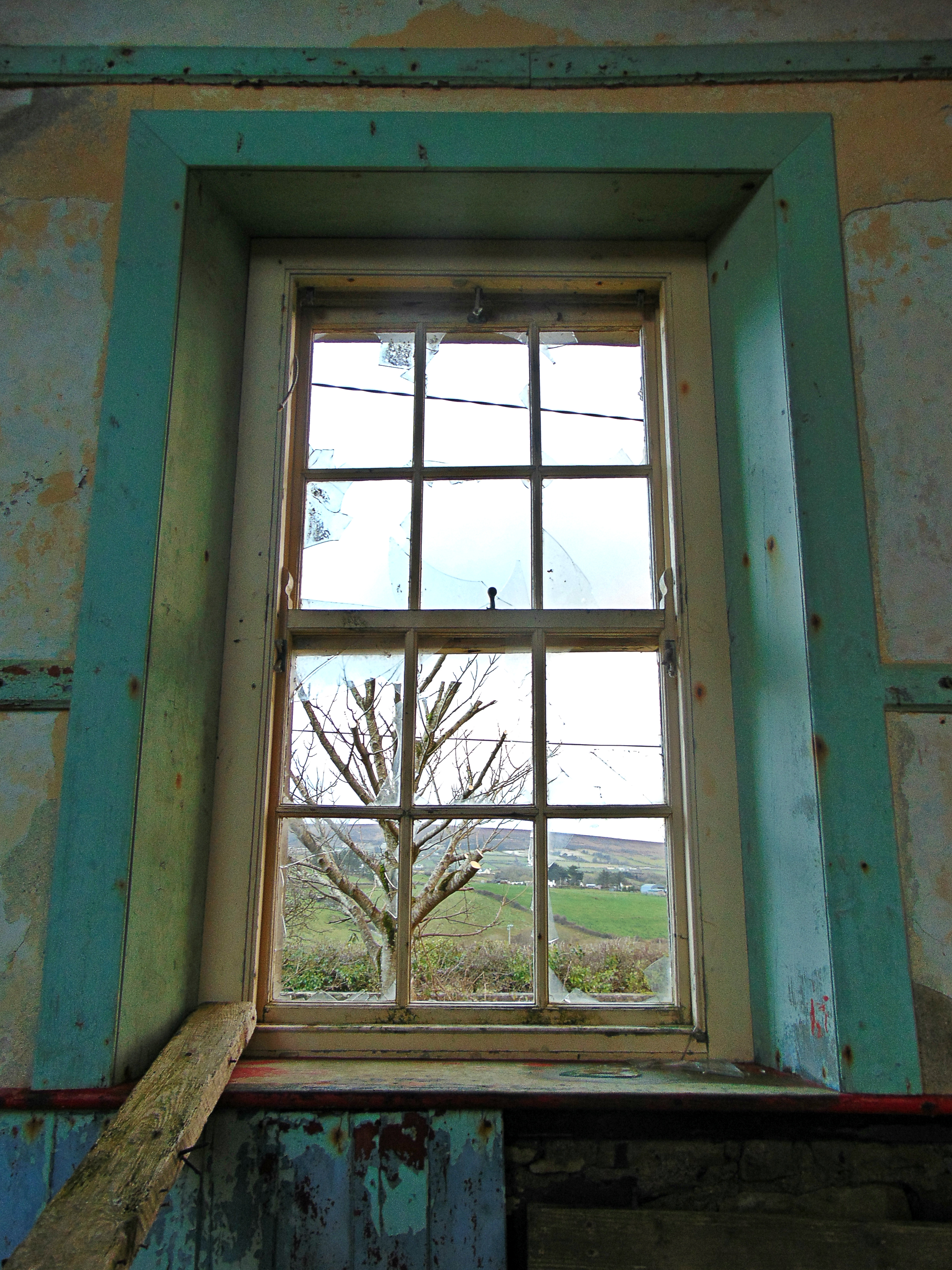
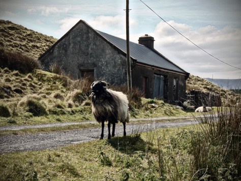
The townland of Greenaun is located to the southwest of the village of Tourmakeady on the shores of Lough Mask in Co. Mayo. The Partry Mountain range lies to the west of the lake, and from there a number of mountain streams tumble and flow down the hillsides and enter Lough Mask below. On the opposite side of the lake to Greenaun, the towns of Ballinrobe and The Neale are located on the relatively-productive flat-lands. In between these two areas Lough Mask glistens like a shimmering silver mirage on a bright day, and lights up the surrounding landscape with the most brilliant light. The Place-name ‘Greeneaun’ translates as solarium; a fort commanding a prospect’. From the elevated position on the west of Lough Mask and looking east with the mountains behind you, the landscape seems open, with panoramic views across the glistening water body and the wild lands of this part of Co. Mayo.

Historically, a large portion of the southern part of the parish of Tourmakeady was formerly part of Co. Galway. However, in 1898 the entire parish was transferred to Co Mayo. Like much of this area around North-Galway/South-Mayo, the wider region was predominately Irish speaking until recent decades. Today, the Gaelic speaking areas in Co. Mayo have been reduced to just three clusters; Erris, Achill Island and Tourmakeady. There are 1,000 people living in the parish of Tourmakeady of which approximately 400 are daily Irish speakers.

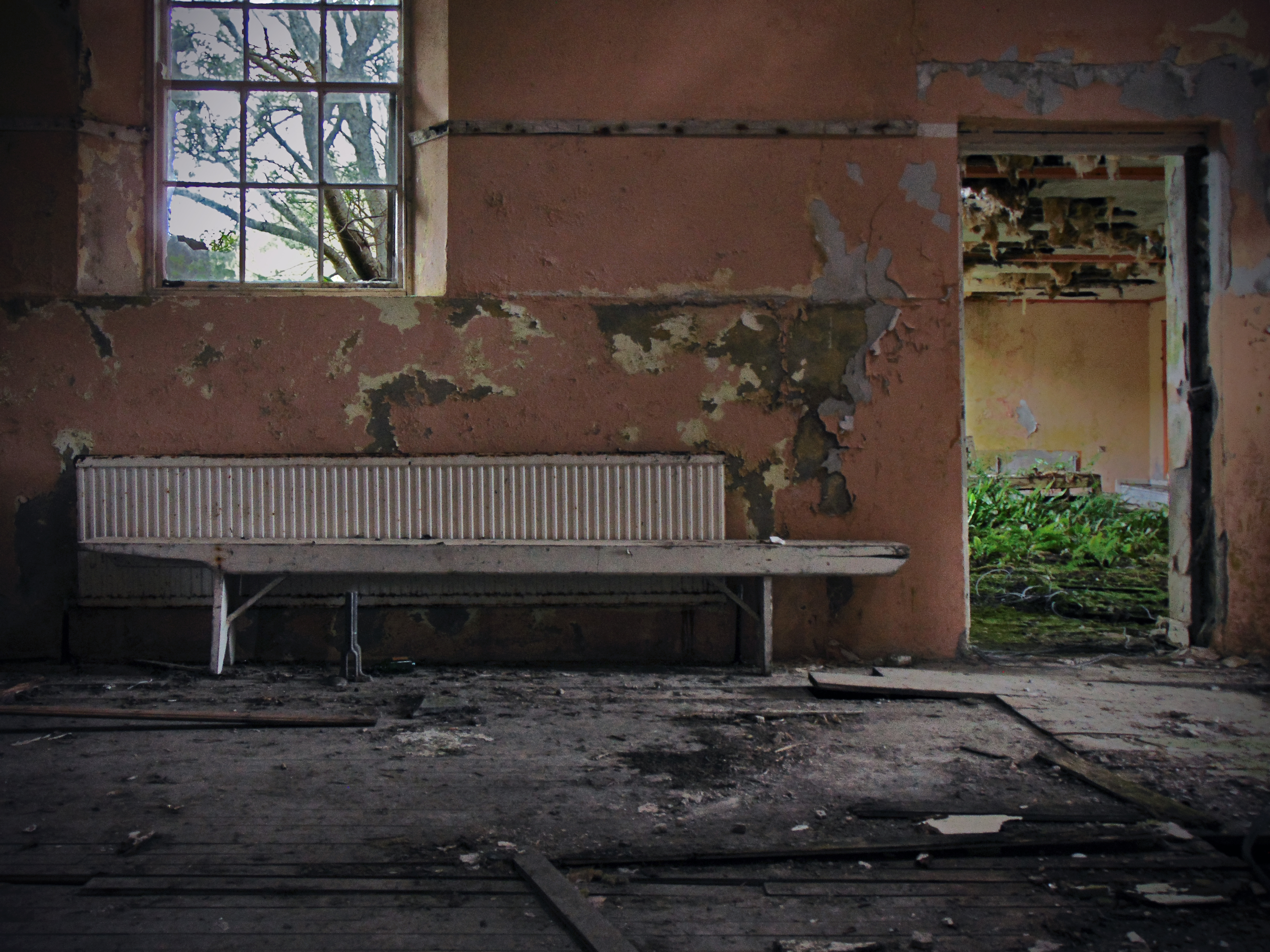
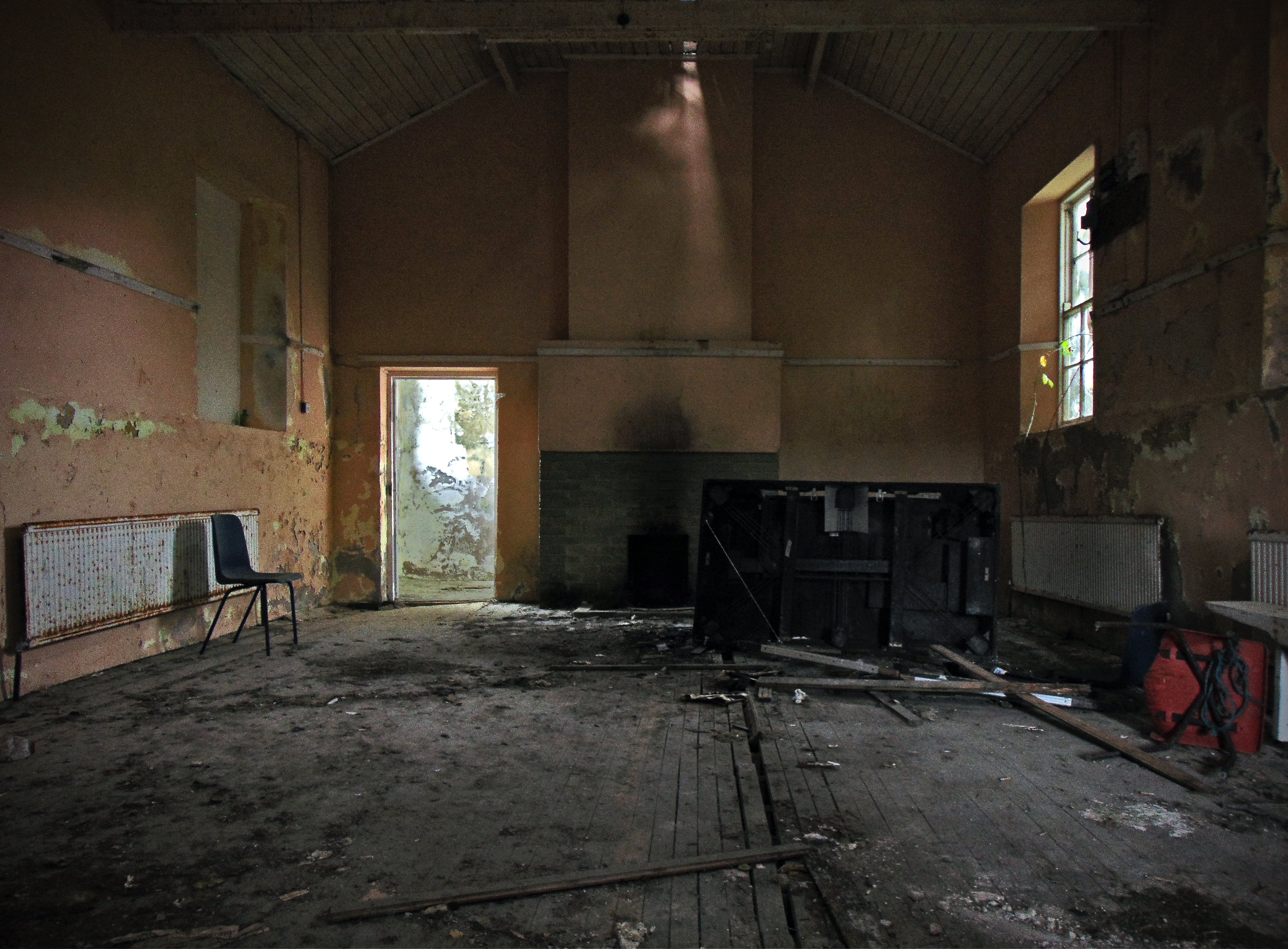
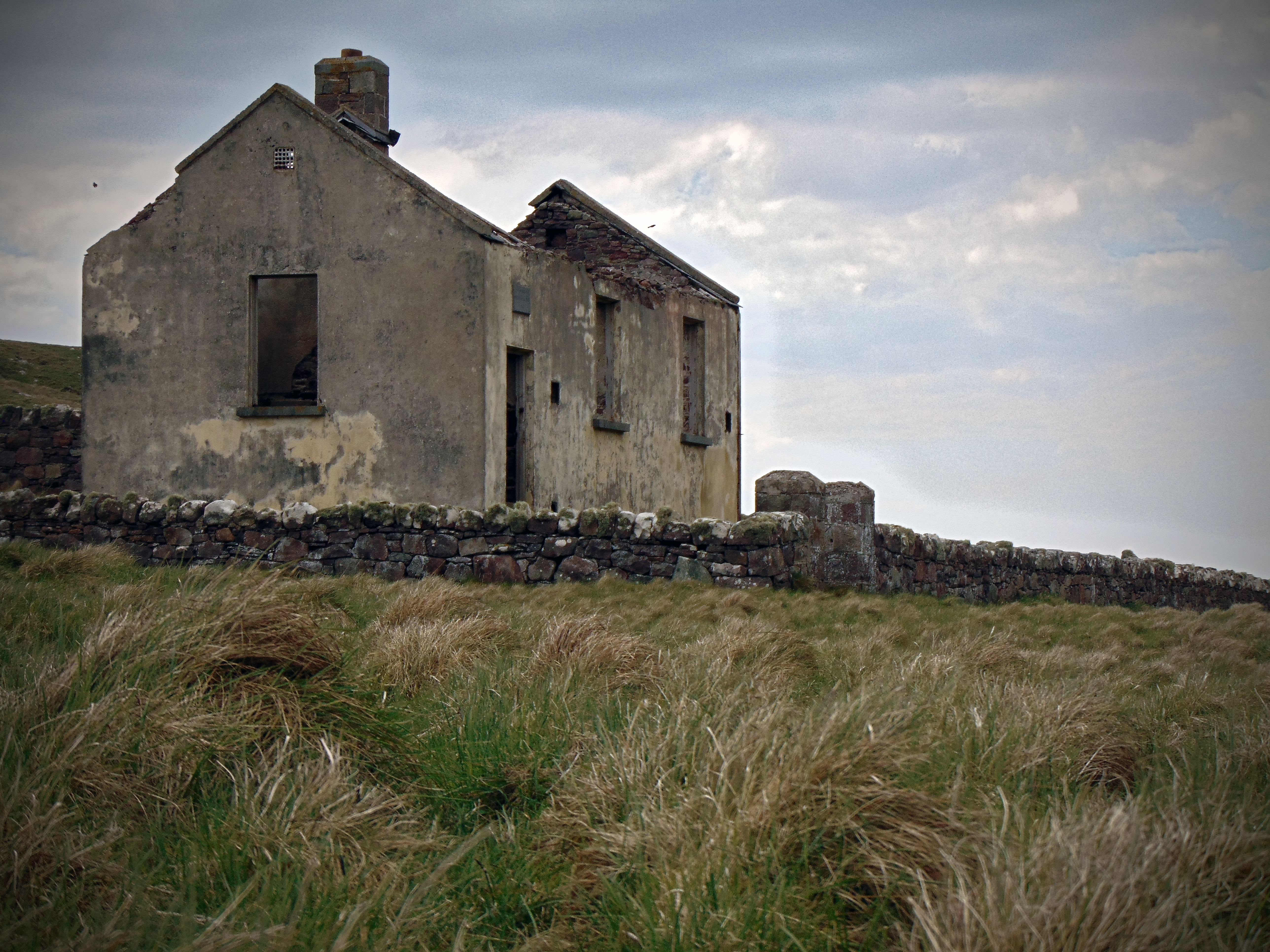
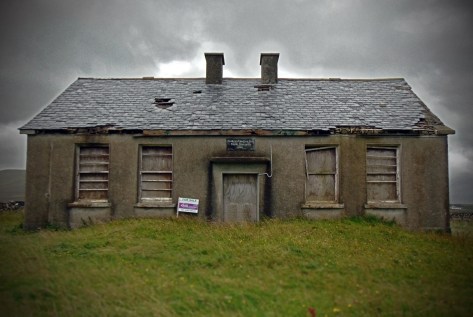
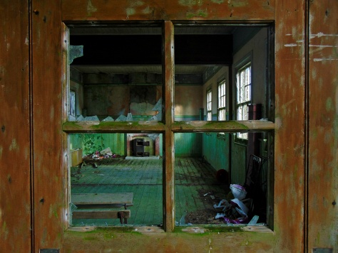
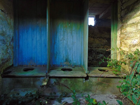
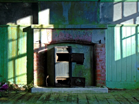
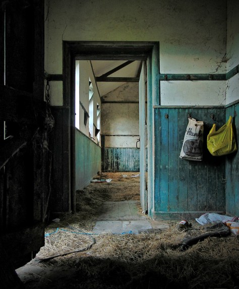
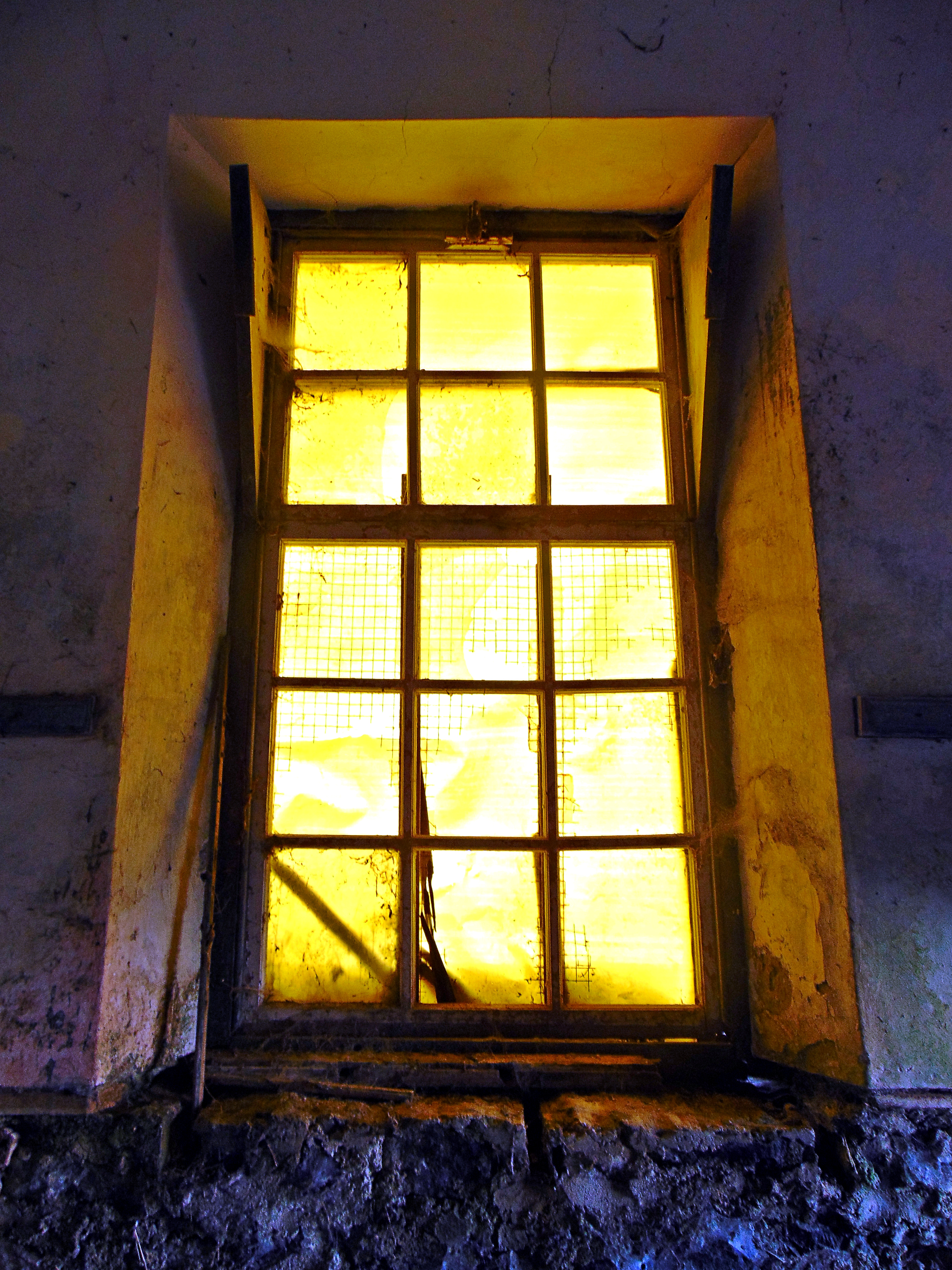
The mountainous landscape was dotted with small farmsteads through the 19th and earlier parts of the 20th century. But the area was devastated during the Great Famine of the mid-19th century and never fully recovered from this tragic event. Like the Irish language, the population dwindled in the years and decades that followed. At the turn of the 20th century, many one-roomed schools were still in use in the area, but as the century progressed, many were closed or consolidated as people left the area and emigrated abroad. Some of these school buildings still remain on the landscape in varying ruinous states, though the population that required them is now gone. Below are some other examples from the immediate area around Tourmakeady:

Derrcraff National School, in the Partry Mountians in Co. Mayo - now used as a cow-house
Derrcraff National School, in the Partry Mountians in Co. Mayo – now used as a cow-house

Continue reading Glensaul National School, Greenaun Townland, Co. Mayo

St. Josephs National School, Letter townland, Islandeady, Co. Mayo

St. Josephs National School, Letter townland, Islandeady, Co. Mayo
(Dated late 19th century)
NGR: 107056, 289784

It’s late evening near Westport in Co. Mayo after an unusually dark day in late July. The sky has been overcast all afternoon and the air is damp but warm. When I think about Irish summers in the west of Ireland this is undoubtedly the weather I think of; June can (sometimes) bring long hot days but once the Atlantic Ocean has warmed up then the air becomes heavy with moisture. June had been exceptionally warm and dry this year, but now the grassy drumlins around this part of Mayo are fresh after a recent rain shower.

I’ve taken a spin out from Westport toward Castlebar. About halfway along this route there’s a boggy rural spot hidden amongst the drumlins called Islandeady. A friend of a friend had let me know that there’s and old school house located out here and so with an hour or two to spare before sunset I went out to take a quick look.

The parish of Islandeady still contains four (small) working national schools; Cloggernagh, Cornanool, Cougala and Leitir. But the school house at Leitir replaced an earlier school building that still stands, and it is this structure that I’m interested in. Today it’s modern successor has just 6 girls and 4 boys on the coming years enrollment, and I wonder if it’s likely to stay open for much longer.

Leitir National School as shown on the First Edition Ordnance Survey 25 Inch Map

The original school house at Leitir is located on a low rise over a small local road just a few hundred metres from it’s successor. In form, the old Leitir schoolhouse is identical to the one at Ballymackeehola National School (also in Co. Mayo) which dates to 1895, and though there is no date plaque at Leitir I would imagine it to be of a similar date.  Continue reading St. Josephs National School, Letter townland, Islandeady, Co. Mayo

Inishkea (south) Island National School, Inishkea south, Co. Mayo

Inishkea (south) Island National School, Inishkea south, Co. Mayo

(Dated (c.1900)
NGR: 55721, 321451

Getting to the Inishkea Islands off the west coast of County Mayo can be difficult. There is no ferry service or regular connection between the mainland and the two offshore islands. Located out beyond Blacksod Bay, apart from flocks of free-roaming sheep and a thriving seal colony, the islands have been uninhabited since 1934.

Inishkea Island - Ordnance Survey 3rd Edition Sheet
Inishkea Island – Ordnance Survey 3rd Edition Sheet

The Inishkea Islands have lain almost untouched since the last permanent residents left. Visitors are infrequent by all accounts, though a man has reportedly been living on the north island for two years without contact, electricity or even a boat.

Pulling into ‘the anchorage’ at Porteenbeg on the sheltered eastern side of the island, you pass the diminutive Rusheen Island where there are the remains of an old whaling station. Ahead on the shore is a line of crumbling stone houses overlooking a white deserted beach. The sea is clear and turquoise, calm and sheltered on the eastern side of the island, even though waves can be seen crashing silently in the distance on the western shore, that coastline being exposed to the wild Atlantic. Continue reading Inishkea (south) Island National School, Inishkea south, Co. Mayo

Finny National School, Finny townland,  Co. Mayo

Finny National School, Finny townland,  Co. Mayo

(Dated 1946)
NGR: 102009, 258477

The wilds of County Mayo are spectacular. Along the rugged west coast the skyline is marked by the Partry and Nephin Beag ranges. On Achill Island, the northern slopes of Croaghaun mountain plummet from 600 m OD to the sea below, while on it’s southern side it shelters one of the most beautiful beaches in Ireland, Keem.  To the southeast of here is Clew Bay with its plethora of low drumlin islands, while inland the landscape is dotted with rivers, lakes, bogland and the occasional turlough.

Lough Mask is located to the south of Co. Mayo. Along the lakes western shore is the village of Tuar Mhic Éadaigh, and if you ever get the chance, I would recommend the trip from here to Westport across the hilly and barren emptiness of Aughagower. The landscape comprises blanket peat that is unproductive, there are few homes though there are the crumbling ruins of many vernacular houses long deserted. Wild and ragged mountain sheep roam the narrow roads.

It is just south of this area that you’ll find the little hamlet of Finny. On high land, it affords spectacular views of a narrow part of Lough Mask. Almost directly across from Dead Island on the lake, and along the R300 road, is Old Finny National School. The building is disused now, and being so off the beaten track, it probably has very few inquisitive visitors.

Continue reading Finny National School, Finny townland,  Co. Mayo

Letterbrick National School, Coolnabinnia townland, Co. Mayo

Letterbrick National School, Coolnabinnia townland, Co. Mayo
(Dated 1880-1900)
NGR: 06162, 07203

Letterbrick National School, Coolnabinnia townland, Co. Mayo

For as long as I’ve been undertaking this disused school houses project, the diversity of the Irish landscape has not failed to routinely take my breath away.  Every region, every road, every little village, every hill, island, or woodland has a unique character shaped initially by the physical landscape, and then by the people who have lived in that landscape through the centuries. Even in areas that seem empty now, the hills and boglands bear the scars of past settlement; redundant field patterns, abandoned tillage plots, collapsing vernacular houses and old mills.  Layers of settlement are written on the landscape, abandoned, and left to future interpretation.

The theme of rural depopulation is reoccurring within this project, and each time I leave my house to head up the country to photograph some old school that is no longer in use, I am invariably going to end up in some empty place where few tourists visit, and where the local population has declined. By and large, I will be driving to somewhere in what were known at the close of the 19th century as ‘The Congested Districts’; the poorest parts of Ireland with the poorest quality land, predominantly located on the west coast.

To alleviate poverty and congested living conditions in the west and parts of the north-west of Ireland, the Congested Districts Board for Ireland was established in 1891. Various political machinations were at play at the time, largely in an effort to deter a desire for home rule, but the basic role of the Congested Districts Board was to alleviate poverty by paying for public works, such as building piers for small ports on the west coast, to assist fishing, modernising farming methods or sponsoring local factories to give employment and stop emigration from Ireland. The efforts largely failed, and the impact of the Congested Districts Board was minimal. In time, the rural landscape would empty.

Many folk lament the decline of rural Irish lifeways; the changing demographics, the inevitable fate of the small farmer and the uncertain future of the land. In these desolate spots, I can spend days rambling through the ruins of defunct livelihoods. Vast expanses of unproductive farmerland on hillsides and bogs have been planted with commercial forest, and in these unnatural woodlands you will find the ghosts of past farmsteads. Across places like northwest Mayo, the remnants of vernacular settlement are swallowed by forestry. Cottages tumble and collapse, schools are closed and left to the same outcome.

Letterbrick National School, Coolnabinnia townland, Co. Mayo

Continue reading Letterbrick National School, Coolnabinnia townland, Co. Mayo

Achill Beg National School, Achill Beg Island, Co. Mayo

Achill Beg National School, Achill Beg Island, Co. Mayo
(Dated 1903)
NGR: 071712, 292437

If you were to include just about every rocky outcrop of notable size, then you could count at least five-hundred-or-so off-shore islands off the coast of Ireland. However, only a handful of these islands have maintained a population through history, and even fewer-still have retained permanent residents into the present day. Through the early and high medieval period many of the smaller islands off the west coast attracted monastic settlers. Off the west coast, monastic settlements can be found on Skellig Michael, St. Macdara’s Island, Scattery Island and Inishmurray to name just a few, with the early monks being drawn to the isolation offered by these punishing out-posts.

However, our period of interest is the 19th and 20th century, and the experiences of those who lived and were educated on these islands at that time. Examining the early mapping sources like the First Edition 6 Inch map (1834-1842), and First Edition 25 Inch map (1890-1911), it can be seen that up until the mid 20th century, there were some forty national schools located on islands off the coast of Ireland. Life on many of these islands could be harsh at the best of times, and by the 1950s, settlers on many of the smaller islands were encouraged to leave and settle on the mainland. The evacuation of the off-shore islands left many of the smaller islands desolate and empty, and consequently, the majority of the forty national schools once located on them were closed.

For the past couple of months I’ve been slowly making my way out to many of these island school houses. Some have unfortunately been completely destroyed by the elements such as the school house once located on the eastern shore of Scattery Island, Co. Clare. Others have been restored as holiday homes like the example on Dursey Island, Co. Cork. And some, such as the example featured here from Achill Beg, have been sitting vacant and abandoned since the island was evacuated in the mid-20th century.

Achill Beg Island National School 1903

Continue reading Achill Beg National School, Achill Beg Island, Co. Mayo

Scoil An Cneagain/Cregganbaun National School, Cregganbaun townland, Co. Mayo

Scoil An Cneagain/Cregganbaun National School, Cregganbaun townland, Co. Mayo

(dated: 1945)

NGR: 080756, 274223

The coastline of County Mayo is a forgotten gem in the Irish landscape. Mountainous and barren for the most part, the area attracts the more adventurous visitors who are willing to stray off the well beaten tourist track that generally takes in the southern half of the island of Ireland. In recent years, the popularity of the Wild Atlantic Way has brought and increase in tourism to the area. When I most recently passed through the region, I was making my way from Kilary Harbour to Westport. Taking the scenic route, my journey brought me northward by the shores of Doo Lough, a small lake that is hidden between the overshadowing Mweelrea and Sheefry mountain ranges.

doo-lough-co-mayo
Doo Lough and Glencullin Lough, Co. mayo

After emerging from the mountain pass, the R335 headed north toward the town of Louisburgh. There was little by way of settlement between the mountain pass and Louisburgh, and the small regional road had little to navigate except expansive boglands with the Sheefry mountains providing a dramatic backdrop. The roadway gently bulged over the peatlands and there was little roadside vegetation to interrupt the view across the bog as I passed the occasional singe rural dwelling. Not many people live here I thought.

Much of this landscape had been empty since the Great Famine of the mid-19th century, and I associate sadness with this particular area. You see the route I was driving was in fact the route of the ‘Doolough Tragedy’, which occurred in March 1849. The Doolough Tradgedy is a journey many starving people were forced to make through the Doolough Valley to attend an inspection and get famine relief at Louisburgh. For unknown reasons the inspection was not made, and the hundreds of people were then told to appear at Delphi Lodge near Kilary Harbour. They walked the eleven miles in cold and wintry conditions, but, when they got to Delphi Lodge, they were refused either food or tickets of admission to the workhouse. On the journey back home more than 400 people died.

The population never recovered after the famine, and there is not much by way of infrastructure here today. Nonetheless passing near the townland of Creggabaun in the Civil Parish of Kilgeever, I came across an old two-roomed school house by the roadside. There was only one house nearby and it’s difficult to imagine a time when a school was needed in these parts.

scoil-an-cneagain-co-mayo-1945-external
Cregganbaun National School, Co. Mayo 1945

The building comprised a detached five-bay single-storey national school, dated 1945. From the outside, it looked as grey and dismal as the foreboding overcast sky that had drifted over when I stopped to take a few snaps. I rushed inside to take shelter from the on-coming rains, and in there I discovered a brightly coloured interior, strewn with rubbish and old furniture.

scoil-an-cneagain-co-mayo-1945-table-top
The Classroom at Cregganbaun National School, Co. Mayo

There were two classrooms, both once heated by oil burners. The plaster fell from the walls revealing the coarse stonework underneath, and the roof looked like it wouldn’t hold out to the elements much longer. To the rear were the toilets, with toilet doors painted a discomforting yellow colour. As the rain began to fall and drip through the holes in the ceiling, I thought to myself that this is one of those schools that people romantically think of as wonderfully isolated and wholesome – the reality being that you are surrounded by the exposed, damp and peaty landscape; truly a delight in the summer, though I’m sure the Atlantic gales can make a wet and dark winter seem very long. Continue reading Scoil An Cneagain/Cregganbaun National School, Cregganbaun townland, Co. Mayo

Shanvaghera National School, Shanvaghera townland, Co. Mayo

Shanvaghera National School, Shanvaghera townland, Co. Mayo

(dated 1935)

NGR: 141379, 285917

Shanvaghera National School, Shanvaghera townland, Co. Mayo (1935)

Shanvaghera National School is situated in the townland of the same name, just off the N17, a few kilometres north of Knock in County Mayo. Although the exterior of the building is not particularly striking, the interior is well preserved. The building is certainly in a ruinous state, with nature invading through the shattered glass and broken doorways. Nonetheless, original features such as the wooden partition that divided the main room into three classrooms, three original fireplaces, and a single school desk add wonderful atmosphere to this building. The separate entrances for boys and girls are to the rear of the school, and the numbered coat hooks once used by the pupils can be seen in the entrance hall. The suspended wooden floor was solid enough to walk on when I visited. The school closed in 1968/69.

Shanvaghera National School, Shanvaghera townland, Co. Mayo (1935)
Shanvaghera National School, Shanvaghera townland, Co. Mayo (1935) – The dry toilets and encroaching greenery

To the rear of the main building is the former toilet block where the wooden elements of the non-flushing latrines remain.

The building comprises a detached, five-bay, single-storey national school, built and opened in 1935, on a T-shaped plan with single-bay, single-storey, lean-to projecting bays centred on single-bay, full-height, gabled projecting porch; there is a seven-bay, single-storey rear (east) elevation. It has a pitched slate roof on a T-shaped plan extending into lean-to slate roofs centred on a pitched (gabled) slate roof with clay ridge tiles terminating in red brick.

Shanvaghera National School, Shanvaghera townland, Co. Mayo (1935)

Continue reading Shanvaghera National School, Shanvaghera townland, Co. Mayo

Ballycastle National School, Carrowkibbock Upper townland, Co. Mayo

Ballycastle National School, Carrowkibbock Upper townland, Co. Mayo

(dated: 1892)

ING: 110455, 337374

Ballycastle National School, Ballycastle townland, Co. Mayo

West of Killala Bay on the north coast of Co. Mayo is the rural village of Ballycastle. On an overcast day, the beauty of this place can be well hidden, and the village can appear unremarkable – despite it’s pleasant setting by the Ballinglen River which flows into the Atlantic nearby at Bunatrahir Bay.

Ballycastle National School, Ballycastle townland, Co. Mayo

Continue reading Ballycastle National School, Carrowkibbock Upper townland, Co. Mayo

Baile Mhic Citheóla (Ballymackeehola), National School, Ballymackeehola townland, Co. Mayo

Baile Mhic Citheóla (Ballymackeehola), National School,  Ballymackeehola townland, Co. Mayo

(dated 1895)

NGR: 116130, 325294

Ballymackeehola NS Co Mayo 1895 Doorway

This rural two-roomed national school is situated in the sparsely populated and boggy townland of Ballymackeehola in north-west Mayo. With little tree cover, the area is often wind-swept, with the Atlantic Ocean sometimes bringing a damp and harsh gale. Lough Conn lies to the south with Kilala Bay lying lying to the east. The nearest urban centre is the town of Ballina located approximately 9 km to the south-east. The surrounding farmland is poorly drained with little or no tillage farming. The First Edition Ordnance Survey sheet for the area shows a number of small Clochan settlements in the townland, although this isolated and now disused school house is perhaps the only evidence of infrastructural investment in the area over the past 200 years. The plaque above the doorway dates the construction of the school to 1895. It remained in use until 1969.

Ballymachola National School, Ballymachola townland, Co. Mayo

The building comprises a detached four-bay single-storey national school with a pitched slate roof with clay ridge tiles, red brick running bond chimney stack having lichen-covered chamfered capping supporting terracotta pots, timber barge-boards to the gables on timber purlins, and no rainwater good surviving on exposed timber rafters retaining cast-iron down-pipes. The interior of the school house remains in a good state of preservation with many of the original fittings and fixtures still in place. Unfortunately, the northern gable of the building has had a hole recently knocked in it to allow livestock enter the smaller classroom. Entering through the hallway/cloakroom, standing in the main classroom and facing the charred chimney breast, it is easy to imagine lessons taking place in this setting, though nothing of the sort has occurred here in nearly 50 years.

Ballymachola National School, Ballymachola townland, Co. Mayo

This dilapidated national school represents an integral component of the later nineteenth-century architectural heritage of County Mayo. A prolonged period of neglect notwithstanding, the elementary form and massing survive intact together with substantial quantities of the original fabric, thus upholding the character or integrity of a national school making a pleasing, if increasingly forlorn visual statement in a sylvan setting. Continue reading Baile Mhic Citheóla (Ballymackeehola), National School, Ballymackeehola townland, Co. Mayo