Tag Archives: Gortachoosh

Scoil Bride Culaid, Cooly townland, Co. Donegal

Scoil Bride Culaid, Cooly townland, Co. Donegal
(Dated 1931)

NGR: 258919, 439198

The picturesque town of Moville lies on the western banks of Lough Foyle in County Donegal where the Bredagh River flows into the sea. The locality was the adopted home of the dramatist Brian Friel, and it still attracts many visitors who make the long journey north to the Inishowen Peninsula and Ireland’s most northerly point on nearby Malin Head.

At the turn of the nineteenth century there were just 50 people living in the town of Moville, but the town would rapidly develop over the following decades. During the second half of the nineteenth century, Moville was a significant point of embarkation for many travellers, especially emigrants to Canada and the USA. Steamships from the Anchor and McCorkell Lines and others en route from Glasgow to New York, Philadelphia, Quebec and New Brunswick regularly dropped anchor in the deep waters off Moville to pick up additional passengers

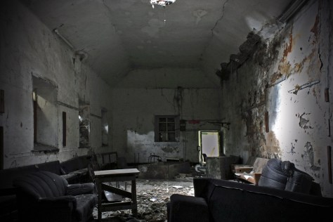
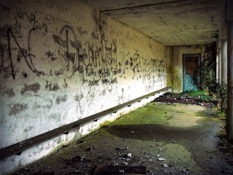
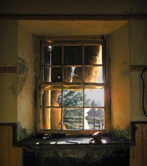
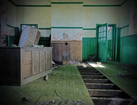
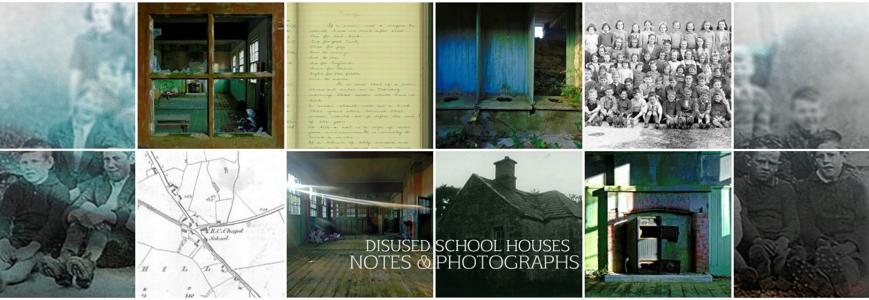
The new trade brought wealth and development to the town, and a growth in population. Naturally, the growing population would need education, and there were a number of national schools constructed, not just in the town, but in the hinterland also. The schoolhouse featured here is one such building. Scoil Bhride Culaidh is located near Cooly Cross, a rural spot just 3km north-west of Moville.

The building itself dates to 1931, but examining the First Edition 6-inch and 25-inch Ordnance survey maps, you can see that this school house replaced an earlier school named ‘Tiyrone School’ just a few hundred metres to the east.  This earlier school house, which dates to at least the 1840s,  was unusually located away from the roadside, enclosed in the corner of a field. Two ‘right-of-ways’ led to the school through the surrounding farmland.  Perhaps someone out there has an explanation for this school’s inconvenient setting?  Was it perhaps built on land donated by a local landowner?  Today, an area of rough ground marks the location of the original school building.

Continue reading Scoil Bride Culaid, Cooly townland, Co. Donegal

Dyzart National School, Dysart townland, Co. Louth

Dyzart National School, Dysart townland, Co. Louth
(Dated 1835)
NGR: 309710, 288382

dyzart-national-school-co-louth-1835
Dyzart National School, Co. Louth 1835

The parish of Dysart (occasionally spelled ‘Dyzart’) is located about 3 kms from Dunleer in Co. Louth, on the coast road from Drogheda to Dundalk. In 1837 the village was visited by the travelling antiquarian Samuel Lewis who reported 699 inhabitants living in the parish at the time. He noted that the land was of superior quality and well cultivated: about two-thirds in tillage, and about 50 acres of bog. In the village of Grange Bellew, there was a mill for grinding oatmeal, and another for dressing flax. Among the most notable buildings in the parish was the old castle of John Bellew in Barmeath (one of the lords of the English pale). At the time of Lewis’ visit it was the residence of Sir Patrick Bellew, and stood ‘in a richly wooded demesne, commanding extensive views of the surrounding countryside’.

In the village of Dysart, Lewis remarked on the handsome chapel there, the site for which was presented by Sir Patrick, who also contributed towards its erection. A quick look at the Ordnance Survey 6-inch sheet which dates to just a few years after Lewis’ visit, shows there were few buildings in Dysart during the 1830s-1840s, bar the aforementioned chapel, and a national school.

First Edition Ordnance Survey 6 inch sheet showing Dysart, Co. Louth.

Lewis recorded that the school of about 160 children was aided by Sir Patrick, who also contributed largely towards the erection of the school-house. Though now derelict, this building still stands today. Continue reading Dyzart National School, Dysart townland, Co. Louth

Munterneese National School, Munterneese townland, Co. Donegal

Munterneese National School, Munterneese townland, Co. Donegal
(Dated 1938)

NGR:183512, 375634

Located in the south of Co. Donegal, and on the northern shore of Donegal Bay, the village of Inver is sometimes referred to as the hidden jewel of the northwest. In recent years, the ‘Wild Atlantic Way’ coastal driving route has brought an increase in tourism to the area, with the parish being situated on the bay of Inver. Nonetheless it remains a quiet spot; rural in character with hilly and rough grazing land that is occasionally lashed by Atlantic winds and rain.

Although now quiet, the area was once home to an important whaling post during the 18th and 19th century, and a large whaling station and fleet was based in the Port of Inver, 2 km from the modern Inver Village.

Thomas and Andrew Nesbitt set up the whaling business in Donegal Bay in 1759. Thomas was the inventor of the gun-harpoon, which was witnessed by Arthur Young during his tour of Ireland 1776-1779, as he states: “From many experiments he brought the operation to such perfection that, for some years he never missed a whale, nor failed of holding her by the harpoon”.The ruins of the old whaling station still remain in the port but have eroded and deteriorated to rubble.

During the 19th century the area was busy enough to require a railway, and Inver railway station opened on 18 August 1893. However the final train passed through the station on 1 January 1960. It has been closed since.

Just a few kilometres east of Inver Village and situated to the south of the old railway tracks, are the townlands of Munterneese and Drumcoe. The townlands are sparsely populated today, though a quick glance at the historic mapping for the area shows that in the time since the publication of the First Edition Ordnance Survey 6 inch map series in the 1840s, there have been no less than four school houses constructed in this small area. Only two if these buildings remain today (both disused), and this blog post looks at the last of these to be constructed; a detached six-bay single-storey national school, dated 1938. Continue reading Munterneese National School, Munterneese townland, Co. Donegal

Lettermore National School, Lettermore townland, Co. Donegal

Lettermore National School, Lettermore townland, Co. Donegal
(Dated 1909)
NGR: 185124, 383735

Lettermore National School Co. Donegal (1909)

The island of Ireland is small but diverse. From the southwesternmost point at Mizen Head in Co. Cork, you need only travel about 550 km to reach the northerly tip of the country at Malin Head in Co. Donegal. But along that journey, you will witness a variety of landscapes, both physical and cultural – each different from the other in striking, or sometimes subtle ways. From productive mixed farmlands for both tillage and stock, to the mire of endless bog, the physical landscape has been shaped and manipulated, initially by geological process, and subsequently by the the people who have lived in it. Particularly in rural Ireland, the physical and cultural landscapes are entwined and form a narrative that is often not immediately clear, that requires an insight into, and interpretation of what shapes the lived experience of the world around you. In short, the landscape and what it contains tells the history of it’s inhabitants.

This blog post features the first abandoned school house from Co. Donegal (the northernmost county in Ireland) that I’ve visited, and it’s difficult to communicate the significance of the school without first placing this building in context.

Lettermore National School, Co. Donegal (1909)

The slogan ‘Up here it’s different’ has been used to promote tourism in, and attract tourists to the Donegal region in recent years. But what makes this area different? In terms of geography, Donegal is pretty similar to West Cork, Kerry and Connemara; a rugged western coastline shaped by the Caledonian Orogeny, and battered by the Atlantic Ocean, mountainous lands of blanket bog to the west, better, more productive lands to the east.

But Donegal different to these other places. Depending on your perspective, the circumstances of history have not done Donegal any favours other than to perhaps help preserve it’s striking landscape. The Partition of Ireland in the early 1920s had a massive direct impact on the county. Partition cut the county off, economically and administratively, from Derry, which had acted for centuries as it’s main port, transport hub and financial centre. But even before this, Donegal was one of the worst affected parts of Ulster during the Great Famine of the late 1840s. Vast swathes of the county were devastated by this catastrophe, many areas becoming permanently depopulated. Vast numbers of people emigrated at this time. Particularly in West Donegal, there was a spiral of decline from the 1900s onward, and what was once seasonal migration from the islands and highlands was replaced by more permanent migration to cities in Britain such as Glasgow.

Lettermore National School, Co. Donegal (1909)

The abandoned school house at Lettermore symbolises the recent history of the region, and the story of migration. Opened in 1909 to meet the educational needs of the local community, the school had a relatively short life. Continue reading Lettermore National School, Lettermore townland, Co. Donegal

Nostalgia, memory and debris; the landscape of Ireland’s old abandoned school houses (Heritage Week 2016 Series)

This week (August 20th – 28th) marks National Heritage Week in Ireland. It is a multifaceted event coordinated by The Heritage Council that aims to aid awareness and education about our heritage, and thereby encouraging its conservation and preservation. As part of Heritage Week 2016 there will be daily posts to the Disused School Houses Blog for the duration of the event to promote awareness of our built and cultural heritage. Below is the first in the Heritage Week 2016 Blog Post series.

Just a few weeks ago I added a post to the blog which provided a little background into why there are so many abandoned national schools scattered across the rural Irish landscape. In short, it’s a story of changing demographics, emigration, depopulation of the rural countryside, and the changing requirements of rural settlement. To begin this series, I thought I’d write a little something about what I find inside these abandoned buildings.

Drumlish Co. Longford c.1930 Shelter
Drumlish National School  Co. Longford built c.1930; Playground shelter

As the title of this post suggests, I’m not just interested in the buildings, their architecture, or the fittings, furniture and the debris that is strewn across these echoing spaces, but also in the stories they tell, their settings, and the nostalgia and memory that make up these cognitive landscapes. As time passes they have a growing significance as relics of a disappearing rural Irish lifeway, especially as the landscape around these school houses changes.

Visiting Reyrawer National School in the Slieve Aughty Hills last Autumn was a fine example of such a disappearing landscape. The autumnal evening sun hung low in the sky, and the few clouds that had lingered as twilight beckoned were tainted red and orange around their fringes by the setting sun. On the low hillside, and hidden in the dense forestry plantation of the Slieve Aughtys, was the now-disused, one-roomed Reyrawer National School; dilapidated and empty, haunting and isolated.The now forested hill-sides were dotted with the ruins of former farmsteads. The former pasture and rough grazing lands had been sown with coniferous plantations, and the ubiquitous and imposing wind-turbines highlighted the movement away from agrarian living in this area, as an alternative and profitable use is sought for this now people-less landscape. In the Aughtys, the result is an empty space, a desolate place where few people live.

Reyrawer National School. Co. Galway 1883 Window
Reyrawer National School. Co. Galway built in 1883

Continue reading Nostalgia, memory and debris; the landscape of Ireland’s old abandoned school houses (Heritage Week 2016 Series)

Gortahose National School, Gortachoosh townland, Co. Leitrim

Gortahose National School, Gortachoosh townland,  Co. Leitrim
(Dated 1890)
NGR: 218430, 307284

gortahose-national-school-co.-letrim-classroom.jpg.jpeg

Just a few miles south-east of the town of Ballinamore in Co. Leitrim, and set amongst the rolling, boggy drumlins and frequent small lakes, is the small rural village of Corrawaleen. During the first part of the 19th Century a small school house was located in the village and is marked on the First Edition Ordnance Survey map for the area. However, in 1890 a new school house was built in the nearby townland of Gortachoosh just outside the village.

This school house still stands today. Though derelict and beginning to collapse, inside, it is in good condition, and the echoes of past schooling can almost be heard amongst the scattered school furniture. It bright daylight, the school rooms seem vibrant still.

Continue reading Gortahose National School, Gortachoosh townland, Co. Leitrim