Category Archives: Co. Galway

Tryhill National School, Trihill East townland, Co. Galway

Tryhill National School, Trihill East townland, Co. Galway

(dated c.1830)

NGR: 178847, 249237

Nineteenth-Century two-storey National Schools are relatively unusual in Ireland, particularly in a rural setting. They often date to the early part of the 19th Century, before the construction of ‘to-plan’ school houses began to be overseen by the OPW, after the the National School Act of 1831. There are exceptions to this of course, such as Clenor and Carraig National School, Co. Cork built in 1884, or Killymarly National School in Co. Monaghan, built c.1850. But these are few and far between.

The rear of Tryhill National School near Islandcase in Co. Galway

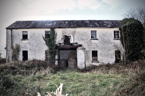
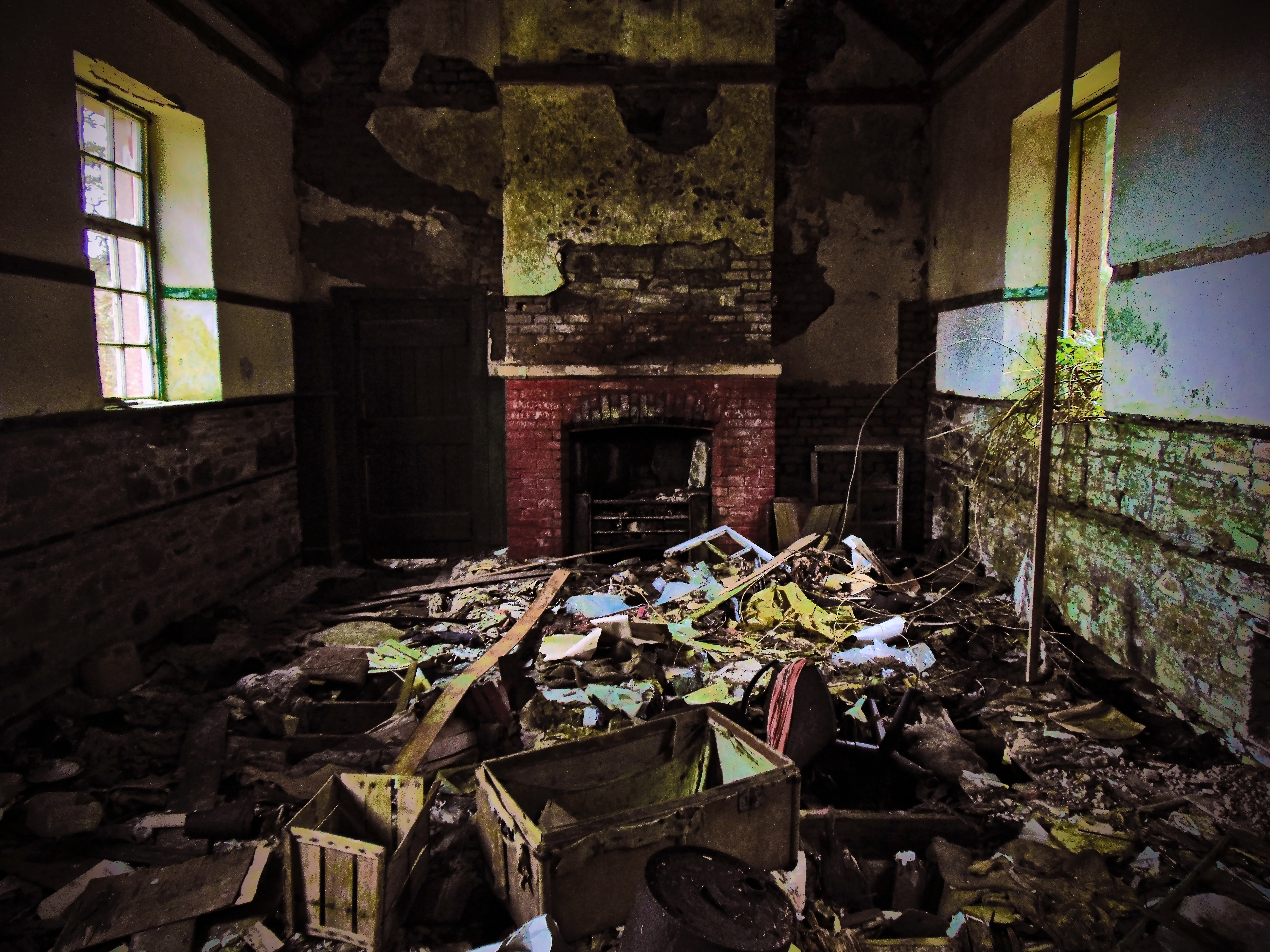
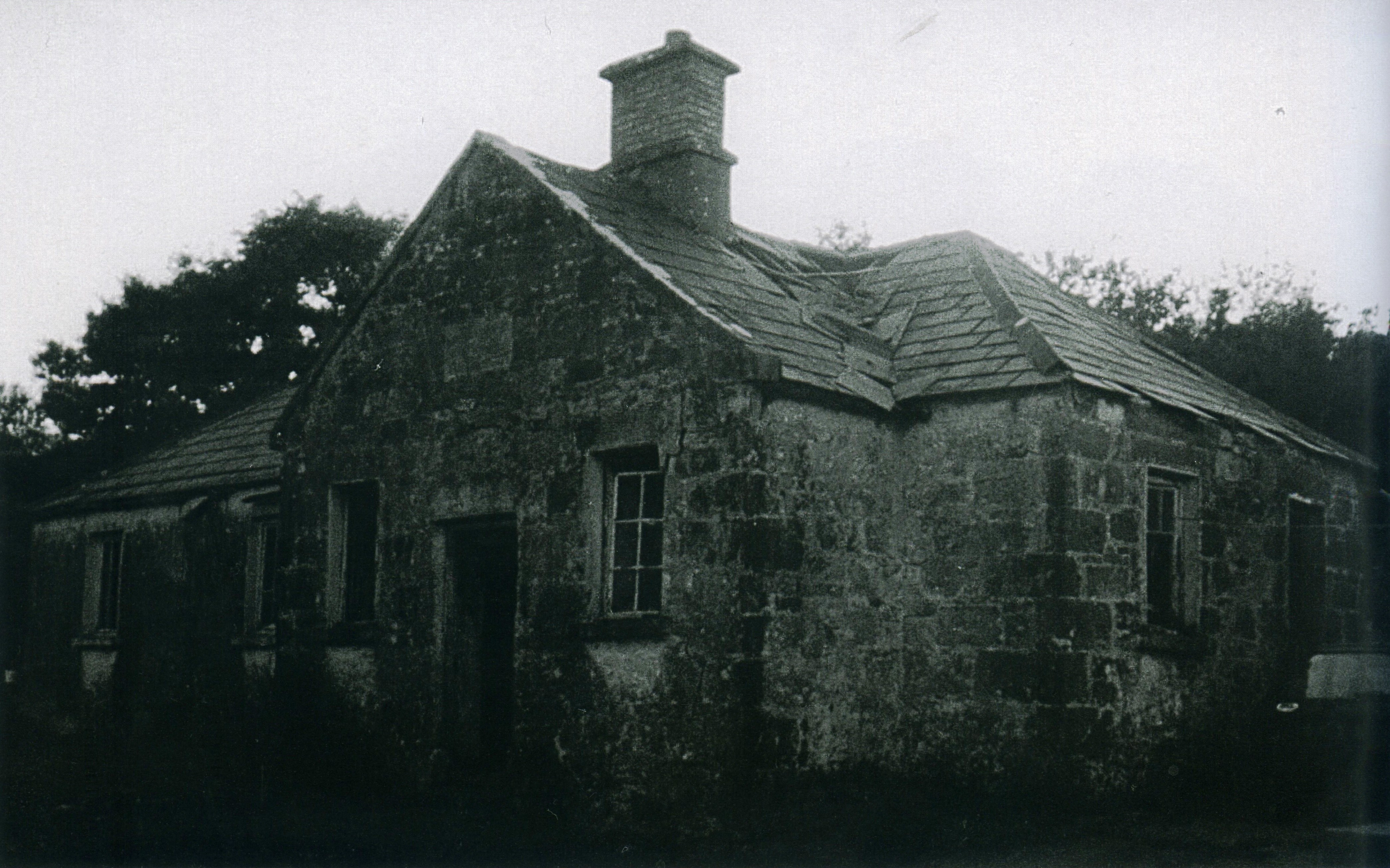
Tryhill National School in Trihill townland in Co. Galway is perhaps on of the best preserved disused two-storey National Schools in a rural setting that I’ve encountered over the past few years – this despite the fact that a gaping hole has been knocked into the rear of the property where a staircase once allowed access to the two classrooms on the upper floor. The building is situated next to the island on the river Shiven in an area known as Islandcase, located to the south of the town of Ballygar in East Galway, and the surrounding landscape is predominantly low-lying and wet with areas of bogland and wet pasture throughout.

Tryhill National School as shown on the First Edition 25 Inch Ordnance Survey Sheet

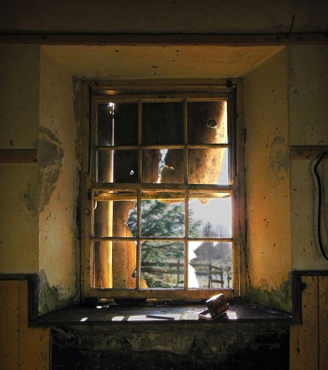
The building comprises a detached, five-bay, two-storey school, built c.1830, but now derelict. Georgian in period, it includes a fine pitched slate roof which still serves its purpose well and which still retains its cast-iron rainwater goods.

The attractive fanlight over the main entrance to the school building

One of the most attractive features of the building is the segmental-headed fanlight over the entrance which in turn retains its original double-leaf timber-ledged and braced door. A stone plaque is still located over the front door and reads; ‘Tryhill National School’; a crude stone cross is included underneath the plaque. The building is set back from road in open ground with a random rubble stone boundary wall to the front, and hedges to side and rear which mark the area of the associated playground. This playground was once divided into boys and girls sections by a high wall.

Tryhill National School - the brightly painted ceiling over the former stairwell
Tryhill National School – the brightly painted ceiling over the former stairwell

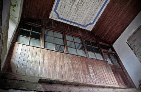
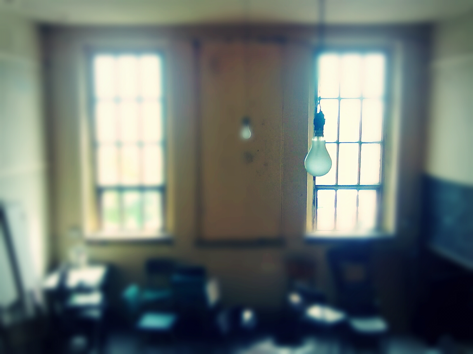
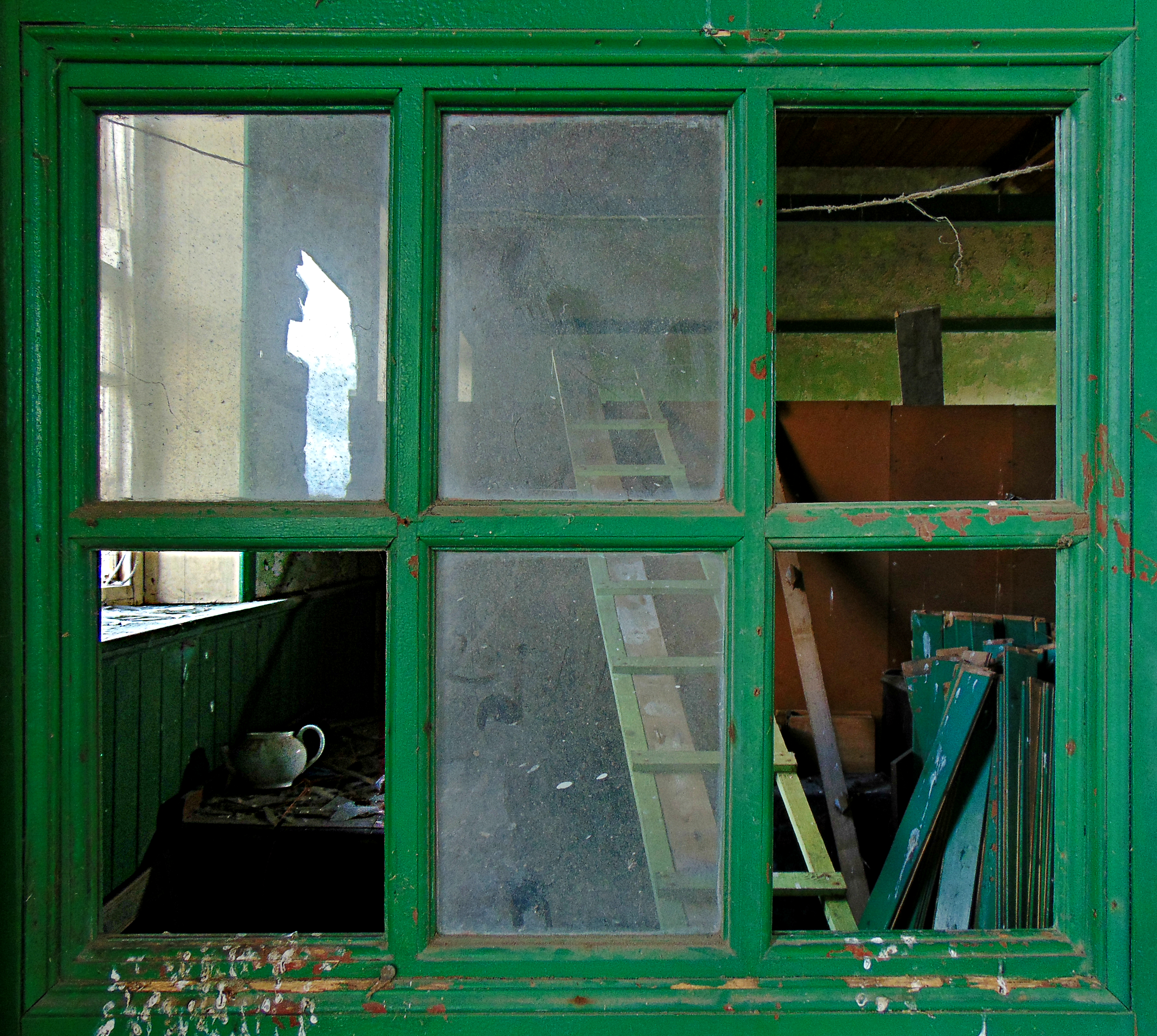
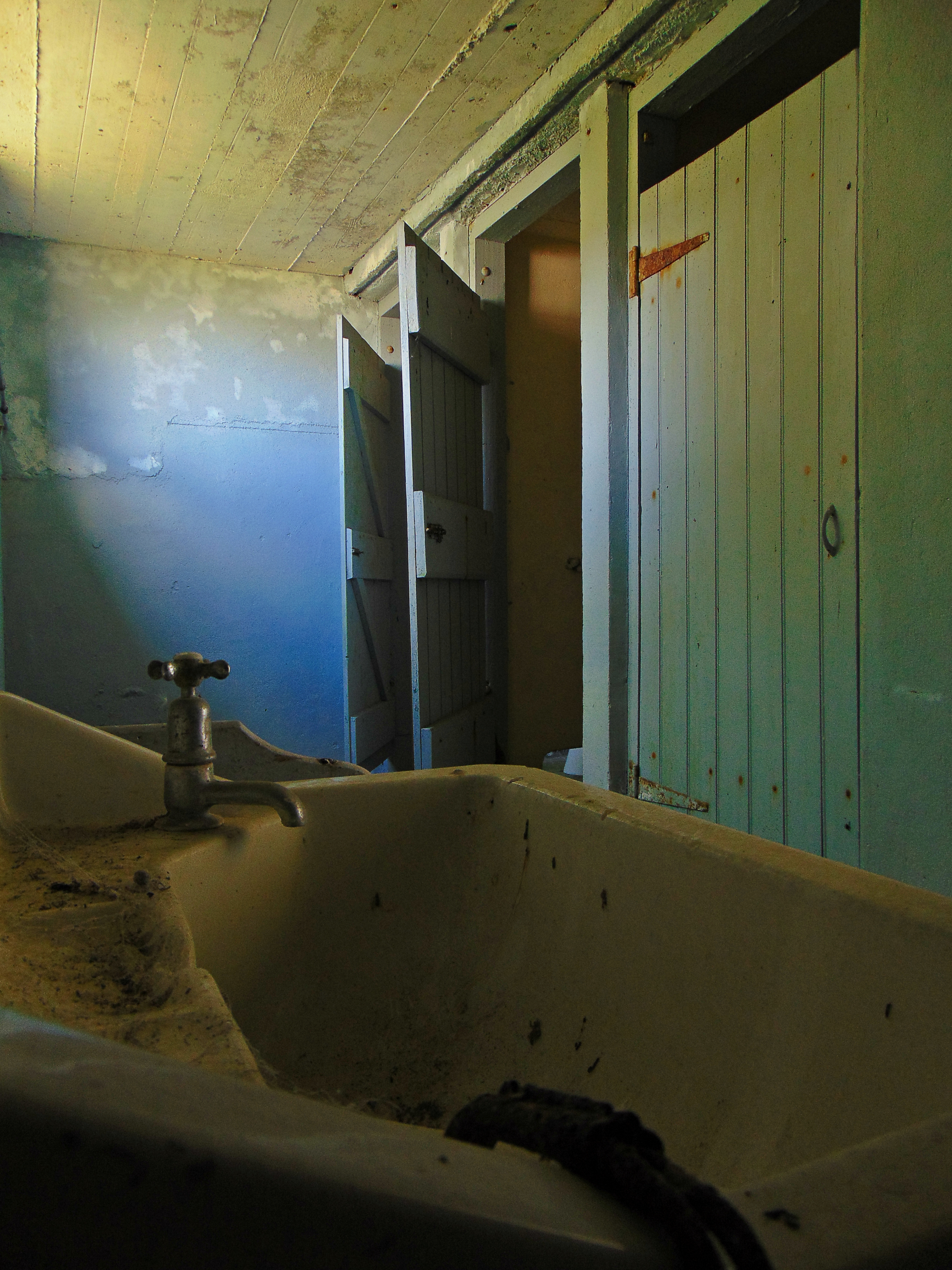
Inside, recent alterations to the stairwell and exterior wall not withstanding, many of the details of the former school still remain. The painted wooden ceiling over the former stairwell remains vibrant, and the wood paneling that separated the first floor classrooms seems nearly as fine as the day it was installed.

The interior of the southernmost upper classroom
The interior of the northernmost upper classroom

Continue reading Tryhill National School, Trihill East townland, Co. Galway

Coolagh National School, Drumatober townland, Co. Galway

Coolagh National School, Drumatober townland, Co. Galway 
(Dated 1930-40)
NGR: 175363, 215440

The rural landscape is not static, and has changed quite a bit over the recent decades. Although the hills, mountains, rivers and lakes don’t move much, the way that people interact with the landscape, and the character of the environment is dynamic and fluid. Rural towns and villages that were once important market places and a hub of rural activity, fade into a mere collective nostalgia for times gone by, as young people gravitate to cities and the landscape empties. I’m from County Galway and anytime I would have travelled to Dublin in the past, it was a straight burn along the N6 through Ballinasloe, Athlone, and on to the myriad of bottlenecks as you approached the capital. In more recent years the M6 means that I rarely see any of these towns anymore.

Before motorised transport and the railway, distance was largely the determining factor when choosing a route from west to east. Travelling from Galway to Dublin by carriage or on foot, it was likely that you would take a route through Loughrea, Killmor and Eyrecourt, crossing the River Shannon at Bangher in Co. Offaly; all the while passing near or along a much more ancient route, An Slighe Mhór.

But this is not the case today when the motorway saves you from having to negotiate town and village streets as you travel.  The reason I mention it is to explain why, that in the three or so years that I’ve been photographing these old school houses, I had not passed by Coolagh in the parish of Abbeygormacan near Killoran (along the former road to Dublin) , and noticed the old school house there. The building is located on the northern side of the N65 about 3 km beyond Gurtymadden Cross when travelling east.

Coolagh National School - Cassini 6-inch Map
Coolagh National School – Cassini 6-inch Map

Continue reading Coolagh National School, Drumatober townland, Co. Galway

Sonnagh National School, Sonnagh Old townland, Co. Galway

Sonnagh National School, Sonnagh Old townland, Co. Galway

(dated: 1891)

ING:159573, 209055

Sonnagh National School, Slieve Aughty Mountains, Co. GalwaySonnagh National School is situated in the Slieve Aughty Hills on the border between south-east Co. Galway and north-east Co. Clare. It is one of a number of disused school houses located in the beautifully desolate landscape of the Aughtys. Like Scoil Cill Criosta and Reyrawer National School, Sonnagh National School stands in the low rounded hills of the Aughtys as a testament to the now dispersed people who lived and farmed in this area in the decades past. The now forested hill-sides are dotted with the ruins of former farmsteads. The former pasture and rough grazing lands have been sown with coniferous plantations, and the ubiquitous and imposing wind-turbines highlight the movement away from agrarian living in this area, as an alternative and profitable use is sought for this now people-less landscape. In the Aughtys, the result is an empty space, a desolate place where few people live. An unintended but welcome consequence of this depopulation is the creation of a welcome retreat from the ribbon development popular across much of the Irish landscape – though the anthropogenic forests bear a hunting watermark of former settlement, with field boundaries, bóithríns, houses, farms, and infrastructure such as disused schools, hidden throughout the forests. When Sonnagh National School was in use, this was a lived-in landscape which supported a scattered, largely agrarian population. With the movement away from this lifestyle, the landscape was emptied and the school was no longer needed. The plaque on the eastern gable of the building dates the construction of the school to 1891. It closed in the late 1950s.

Sonnagh National School, Slieve Aughty Mountains, Co. Galway II

Continue reading Sonnagh National School, Sonnagh Old townland, Co. Galway

Scoil Cill Criosta, Ballingarry townland, Co. Galway

Scoil Cill Criosta, Ballingarry townland, Co. Galway

(dated: 1931)

NGR: 156858, 213606

Scoil Cill Criosta - Scoil Naisunta, Co. Galway III

The Slieve Aughty Hills straddle the border between south-east Co. Galway and north-east Co. Clare. Desolate and empty of human settlement, this striking landscape comprises low rolling hills, damp peat-lands, forests and mountain streams, and offers a great stillness and a sense of solitude to visitors. The area features one of the most extensive forestry units in Ireland with 33,150 Ha of mountain land under management. A maze of forestry roads allow access to the interior of the hilly terrain where wild horses and deer roam the blanket peat, and the extensive forestry plantations are punctuated by wind turbines. Few people still live in this area, though the ruins of former farmsteads can be found among Coilte coniferous plantations. The village of Kilchreest is situated on the north-eastern edge of the hills, with the town of Loughrea lying to the north-east. The disused school house Scoil Cill Criosta  (Kilchreest National School) lies to the south of Kilchreest village at Three Kings Gap on lands that slowly rise toward the emptying hills.

Scoil Cill Criosta - Scoil Naisunta, Co. Galway II-I

Continue reading Scoil Cill Criosta, Ballingarry townland, Co. Galway

Réidh Reamhar (Reyrawer) National School, Reyrawer townland, Co. Galway

Réidh Reamhar (Reyrawer) National School, Reyrawer townland, Co. Galway

(dated 1883)

NGR: 153849, 201664

Reyrawer National School. Co. Galway 1883 Window

Reyrawer (meaning thick field or mountain plain) National School is situated in the uplands of the Slieve Aughty Mountains in the parish of Peterswell (Kilthomas), south-east Co. Galway. Today, when standing in the doorway of the school house, surrounded by the coniferous forestry plantations, the elevated aspect affords excellent views of the karstic landscape of the Gort lowlands to the south. Despite the fact that the uplands are today abandoned, there are a maze of small roads and field boundaries through the forest lands and across the fresh hillside. The 1911 census shows 14 families living in the townland of Reyrawer at that time. Nonetheless there is now a great sense of emptiness in this landscape. With many of the vernacular houses of those who once lived here being swallowed up by the forestry plantation, the school building feels like the last reminder of the communities that once populated this area.

Reyrawer National School. Co. Galway 1883 Light through the Door

This is a detached one-room school house with an attached entrance hall to the south. Inside, the suspended timber floor has begun to collapse, though the pitched roof remains in good condition, with the interior remaining protected from the elements. To the rear of the main building is the former toilet block while to the west lies the cast-in situ concrete schoolyard shelter.

Reyrawer NS 25 inches to one mile c1900

Among the past pupils of the school is Patrick Glynn, member of Kilbecanty Coy. Irish Volunteers, Co. Galway, 1917-21. Glynn was born on the 17th February, 1891 at Lisbrien in the parish of Kilbecanty, Co. Galway and attended the Reyrawer National School until he was about fifteen years of age. Continue reading Réidh Reamhar (Reyrawer) National School, Reyrawer townland, Co. Galway

Loughwell National School, Laughil townland, Co.Galway

Loughwell National School, Laughil townland, Co.Galway

(dated mid-1950s)

NGR: 117846, 228891

May – Driving between Moycullen and Spiddal in Co. Galway: Loughwell is a townland of Moycullen in the Galway Connemara Gaeltacht. Loughwell school stands on the Moycullen Spiddal road there. The school house that stands there today dates to the mid-1950s, but replaced an earlier building that stood on the site. The earlier building is identified on the Second Edition Ordnance Survey sheet for the area:

Loughwell abandoned National School

110520143511

The two-classroom school was constructed probably during the first decade of the 20th century. In the 1970s  the small national school at Loughwell closed and was amalgamated with Scoil Mhuire in Moycullen when the new central school was built there and opened in 1979.

110520143509

110520143519

110520143516

110520143497

110520143501

110520143534 copy c

Loughwell Pre 1950

Continue reading Loughwell National School, Laughil townland, Co.Galway

Kilcoona National School, Mausrevagh townland, Co. Galway

Kilcoona National School, Mausrevagh townland, Co. Galway

(dated early 20th century)

NGR: 130804, 244174

Kilcoona National School, Kilcoona townland, Co. Galway

Kilcoona National School is situated in the townland of Mausrevagh in Co. Galway. The surrounding landscape comprises rolling improved farmland on shallow soils over limestone. Turloughs and other features of a karst landscape are common here, along with archaeological evidence for human settlement since at least the Bronze Age. During the Early Modern period the surrounding area supported a rural population, with the nearest significant town being Headford, about 5 km to the north. Travel between Headford and Galway City was by Kilcoona until the mid-19th century when the Curragh Line was constructed through the bog lands to the east of Lough Corrib.

The school building itself is a simple design, typical of late 19th and early 20th century school houses. It is a detached, eight-bay, single storey, two-roomed school house with a projecting entrance porch to the front, and probably dates to the late 19th or early 20th century. It has not been in use as a school building since the late 1980s but remains in a fair state of preservation. It is currently being used for storage.

2IMG_20140921_141041

Continue reading Kilcoona National School, Mausrevagh townland, Co. Galway

Brooklawn National School, Fartamore townland, Co. Galway

Brooklawn National School, Fartamore townland, Co. Galway

(dated 1885)

NGR:138889, 259222

ADSC00483

In 1937 Margaret Dunne, (then only a school girl at Brooklawn NS) wrote of her local district: ‘All those old people can speak the Irish language… …a good deal of people went to America… …each farmer has only nine or ten acres.’ Brooklawn National School is situated in the townland of Fartamore in the parish of Kilconly in east County Galway. It is now derelict but in relatively good condition (although recently a large hole has been knocked in the rear wall). The place-name Fartamore means ‘great/big grave’. Like so many of the disused school buildings that punctuate the rural Irish landscape, Brooklawn represents a time now past when there was a need to provide easily accessible local education for the children of a rural farming population. Today its empty, collapsing shell also poignantly reflects social change and the impact of rural depopulation and migration to the larger urban centres in Ireland – the movement away from the land and farming.

ADSC00471

Continue reading Brooklawn National School, Fartamore townland, Co. Galway

Hollygrove National School, Hollygrove townland, Co. Galway

Hollygrove National School, Hollygrove townland, Co. Galway

(dated 1899)

NGR: 178226, 257469

ADSC00644

Like so many disused national school buildings present in the rural Irish landscape, the simple ‘to-plan’ architecture of Hollygrove and it’s isolated location in north Co. Galway reflects somewhat juxtaposed concepts of rural homogeneity (a school building like many others, built cheaply and ‘to-plan’ by the state administrators for a homogeneous local rural population) and the uniqueness of each rural area in its isolation (built in a isolated spot near the shore of Ballaghdacker Lough, seemingly far removed from the offices of design and planning – like so many other civic buildings planted in these locations from afar).

Hollygrove 2nd Edition OS sheets

Above is the Second Edition 25 inch to 1 mile OS sheet for Hollygrove showing the location of the School to the southwest of Ballaghdacker Lough at the turn of the 20th century

Each of these schools is undoubtedly similar in a broad sense (each school was to serve the same general role as an institute of education), but also undoubtedly unique. For the casual onlooker today, this school house could be confused with many others of a similar design, however, for those children who attended the school, the building was unmistakable – identifiable through minor unique qualities or its landscape setting. Hollygrove, or sometimes Holly Grove, is a townland of 283 acres in Athleague parish, Killeroran district, Killian barony, Union of Mountbellew, in County Galway. The townland is on the border of Roscommon and Galway. Hollygrove National School is situated to the southwest of Ballaghdacker Lough in the townland.

AADSC00615

Continue reading Hollygrove National School, Hollygrove townland, Co. Galway

Toberroe National School, Toberroe East townland, Co. Galway

Toberroe National School, Toberroe East townland, Co. Galway

(dated c.1901)

NGR: 169382, 265952

Toberroe National School - view from the rear

Toberroe National School is located in the townland of Toberroe East in North Galway. Although constructed around 1901 Griffiths Valuation of c.1855 shows that lands belonging to John Cheevers were at that time exempt from taxation as part school grounds and buildings. This would indicate that an earlier school house was in existence in the townland at this time.

Griffith's Valuation Toberroe II

This earlier building can be identified on the north-eastern boundary of the townland on the First Edition Ordnance Survey sheet for the area (dating to c.1840). The present building continued in use until recent times and is in a good state of preservation with much of the old school furniture still inside.

Toberroe First Ed

The present building comprises a detached eight-bay single-storey national school with separate entrances to rear for boys and girls. It has a pitched slate roof with render eaves, red brick chimney-stacks and cast-iron rainwater goods. The walls are rendered ruled and lined, having an inscribed limestone plaque. it includes square-headed windows having timber six-pane upper flaps over nine-pane fixed lights. There is a garden to front bounded by rubble limestone wall with gateways having square piers with chamfered caps and metal gates. To the rear is the former toilet block for male and female children.

ADSC00543

Continue reading Toberroe National School, Toberroe East townland, Co. Galway